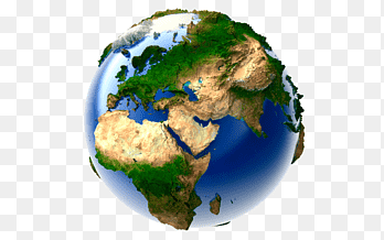
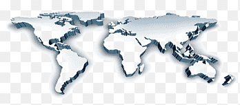
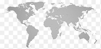
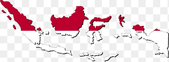
Geography Map Cartography Mascube Information, map, service, measurement png

PNG keywords
- service,
- measurement,
- flower,
- map,
- geospatial Analysis,
- organization,
- petal,
- security,
- transit Map,
- automatic Numberplate Recognition,
- management,
- line,
- information,
- graphic Design,
- geography,
- geographic Information System,
- computer Software,
- cartography,
- travel World,
- png,
- sticker png,
- free download
PNG info
- Dimensions
- 1551x884px
- Filesize
- 263.4KB
- MIME type
- Image/png
resize png
width(px)
height(px)
Non-commercial use, DMCA Contact Us
Relevant png images
-

earth illustration, Geographic Information System GIS Day Geographic data and information Geography Map, Earth In, globe, world png -

Geographic Information System Mastering ArcGIS Geography Geographic data and information, map, text, map png -

Geographic Information System Geography Geospatial analysis Map, map, world, data png -

Geographic Information System Geography Map Cartography, gis s, angle, data png -

man sitting in front of computer monitors, Network operations center Network monitoring Management Information security operations center Business, analyst, computer Network, service png -

Geographic Information System Computer Icons ArcGIS Map Geospatial analysis, map, angle, logo png -

planet earth artwork, Esri ArcGIS Server Geographic Information System Computer Software, previous icon, symmetry, sphere png -

ArcGIS Esri Geographic Information System Map, map, angle, map png -

Geographic Information System QGIS ArcGIS Geography GIS applications, map, grass, map png -

Globe United States World map, creative watercolor world map material, multicolored world map illustration, border, watercolor Painting png -

Geographic Information System Technology Business Consultant, analysis, electronics, service png -

Earth World map Globe Geography, earth, 3D Computer Graphics, world png -

OpenStreetMap Geographic Information System Geographic data and information Open Source Geospatial Foundation, information, wikimedia Commons, road Map png -

Geographic Information System Geography Spatial analysis Digital mapping Raster data, map, service, grass png -

human illustration, Management Information Task Managed services Software, 3D villain, computer Network, white png -

white and teal island illustration, World map United States Continent, Beautiful world map, blue, globe png -

assorted-color boards, Chart Infographic Information, PPT Chart, label, text png -

ArcGIS Geographic Information System Esri Cartography, map, map, data png -

Computer security Information technology Organization Technical Support, text, service png -

United States World map Globe India, map, globe, monochrome png -

graphics Map Geographic Information System Location, map, text, orange png -

phone repair illustration, Information technology Managed services Technical Support IT infrastructure, Blue technology, computer Network, electronics png -

Geographic Information System Computer Icons Map Icon design, map, angle, logo png -

Digital mapping Geographic Information System Geospatial analysis OpenStreetMap, map, service, map png -

Computer Software Cartography Map Geographic Information System Safe Software, cartogrpahy, data, map png -

United States Avatar Organization Information, user avatar, service, united States png -

GIS fundamentals Geographic Information System Geography Map, map, angle, text png -

world map clip ary, World map Globe, world connection, world, map png -

World map Continent, map, border, world png -

Flag of Indonesia Globe Map, indonesia map, red and white map illustration, love, white png -

world travel illustration, World map Globe Travel, Global Travel, logo, world png -

Internet of Things Computer security Computer network Security hacker, computer Network, text png -

Customer relationship management Sales Business, Marketing, company, text png -

System integration Business Information technology E-commerce, Business, computer Network, text png -

map illustration, Geography of Pakistan Map Geography of Pakistan, pakistan, independence Day, wikimedia Commons png -

blue and gray globe, Business Corporate travel management Company Service, satelite, company, globe png -

blue, yellow, and red Philippine map, Flag of the Philippines Map Flag of the Philippines, philippines, flag, world png -

Cartography Computer Icons Map Computer Software Symbol, cartogrpahy, map, world Map png -

red and black abstract painting, Flag of Japan Map Country, japanese culture, culture, flag png -

Globe World 3D computer graphics Visualization Map, earth, infographic, 3D Computer Graphics png -

Geographic Information System Geography GIS Day Geographic data and information, layer, angle, data png -

four laptops illustration, Computer network Lossless compression Data compression, Networking, service, computer png -

eyeglass, paper, pencil, and calculator, Data analysis Big data Management Data processing, report, text, people png -

blue pullover hoodie, Security hacker Vulnerability Password, hacker, blue, computer Network png -

Globe Geographic Information System Computer Software Systems Tool Kit, globe, 3D Computer Graphics, world png -

Enterprise resource planning Software Testing Penetration test Implementation Computer security, erp s, text, logo png -

speech bubbles, Mind map FreeMind, Color dialog box Baiyun thinking analysis map, infographic, template png -

laptop computer encryption art, Computer security Managed security service Information technology Cyberwarfare, computer Network, service png -

Business process Management Organization, target, blue, company png -

QGIS Geographic Information System Open Source Geospatial Foundation PostGIS Computer Software, installation, text, logo png


